ChatGPX
Stop jumping between five apps to plan one mountain day.
Avalanche bulletin, weather, route beta, avalanche data, and routing: everything in one place.
Aggregated data from


Everything to plan, draw, and debrief
All your data in one place
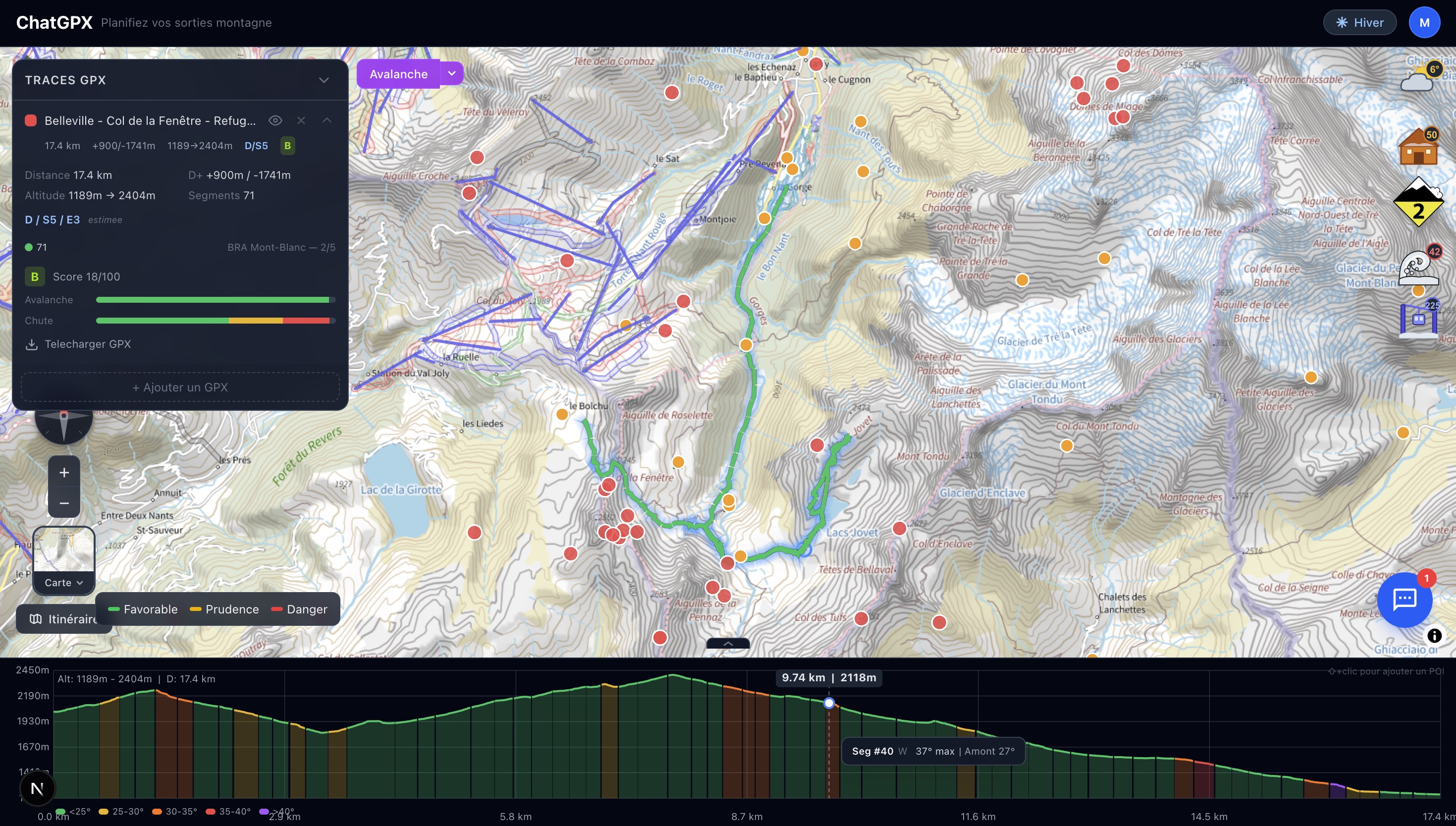
Avalanche bulletin, mountain weather, route beta, trip reports, huts, ski lifts, and avalanche observations on the same IGN map. No need to open five tabs anymore.
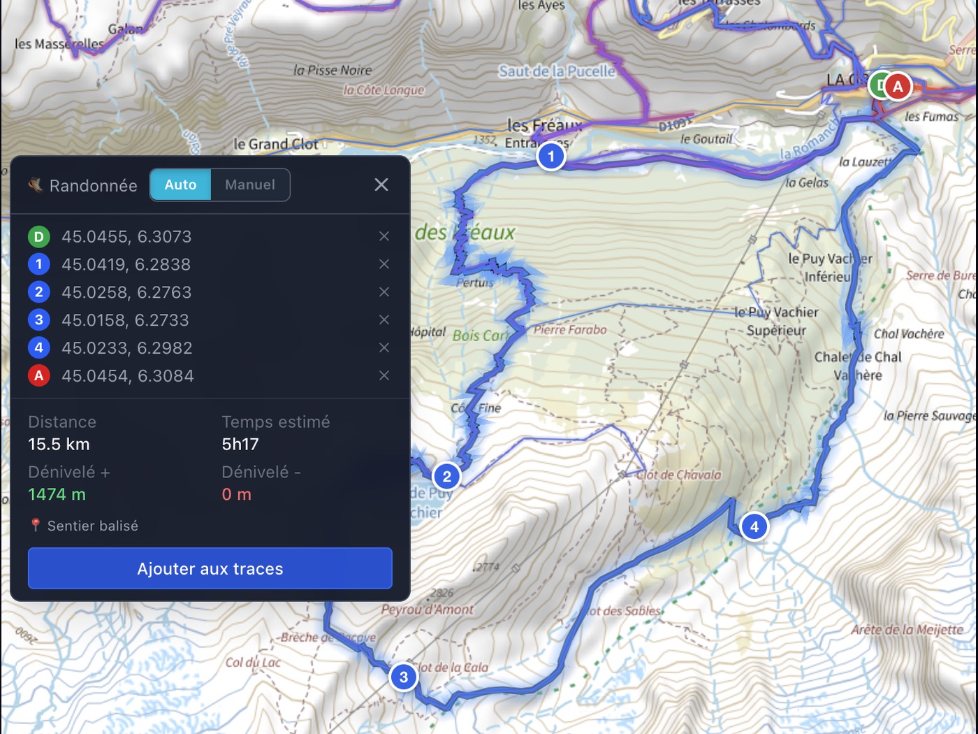
Build routes directly on the map
Draw on the IGN map or let the routing engine do it for you. The community track heatmap shows where people actually go. GPX import and export included.
A profile matched to your level
Connect Strava and ChatGPX analyzes your history: vertical gain, route grades, and mountain ranges to build your profile. The AI adapts to your real experience, not a self-declared level.
A mountain AI that works with you
Ask questions as if you were talking to a mountain partner. The AI checks live data, cites sources, remembers your preferences, and lets you tune its personality.
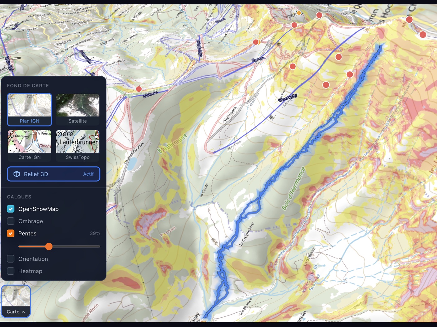
IGN map, 3D, slope angle, aspects...
IGN basemap with 3D view, colored slope overlay, aspects, community heatmap, and ski lifts. Stack the layers you need to read the terrain at a glance.
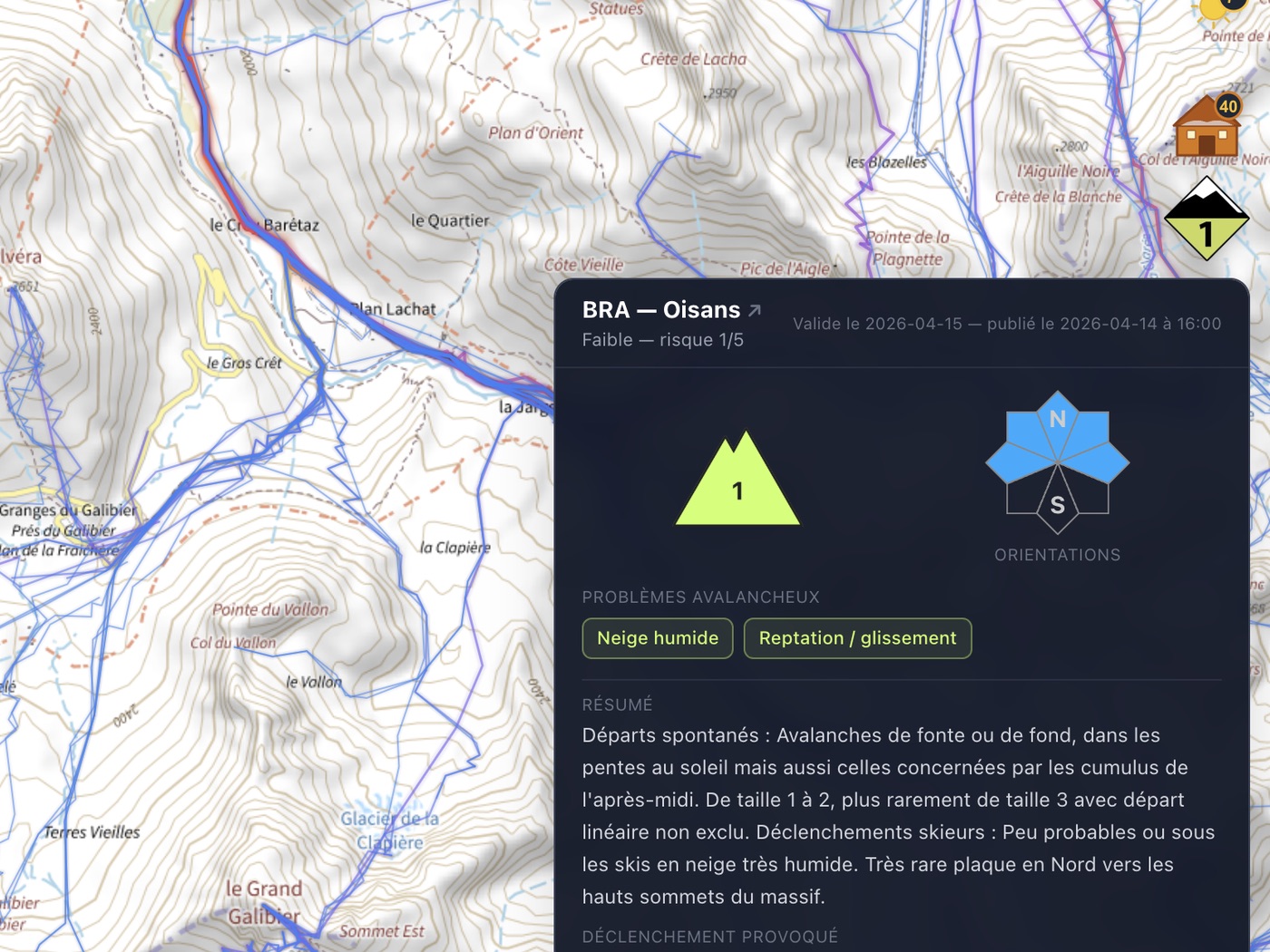
Avalanche bulletin, avalanche reports, weather: no more five tabs
The avalanche bulletin opens directly on the map, together with geolocated observations and altitude-based weather. All data comes from public sources including Météo-France, IGN, Camptocamp, and Skitour, and stays traceable.
Draw routes while seeing where others go
Routing mode shows the community track heatmap. Drop waypoints and let the engine compute the best route. Switch to manual drawing for off-trail sections. Distance, elevation gain, and estimated time update live.
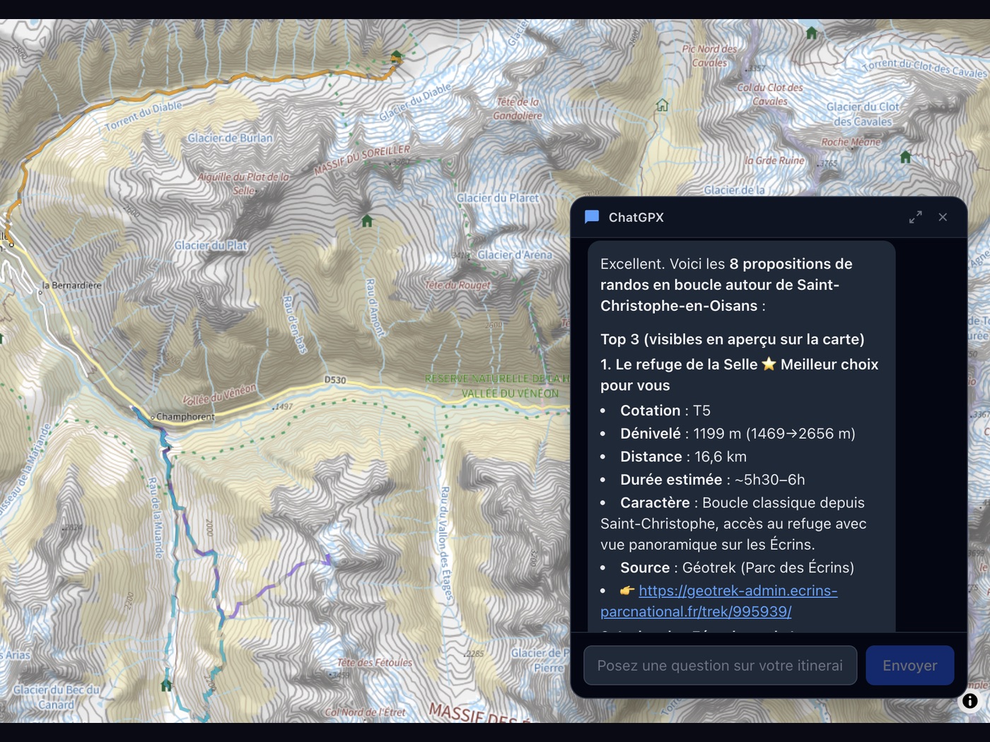
“Suggest a loop hike from Saint-Christophe”
Ask in natural language. The AI checks the data, suggests routes that match your level, and displays them directly on the map. It can also help you debrief after the day.
Summer and winter
The data and the AI automatically adapt to the season.
Summer
Hiking, mountaineering, trail running, via ferrata
- ✓ Thunderstorm risk in the mountains
- ✓ Trail status and conditions
- ✓ Hut planning
- ✓ Hiking routing profile
Winter
Ski touring, snowshoeing, winter mountaineering
- ✓ Avalanche bulletin with AI analysis
- ✓ Geolocated avalanche observations
- ✓ Ski lift status
- ✓ Ski touring routing profile
Frequently asked questions
What is ChatGPX?
Where does the data come from?
How does the experience profile work?
Which activities are supported?
Is ChatGPX free?
Does ChatGPX replace a mountain guide?
Mountains involve real risk
ChatGPX is a planning aid. It does not replace mountain safety training, field judgment, or the experience of a professional. Always verify conditions yourself before heading out.
If you are unsure about the conditions or your level:
Find a mountain guideReady to simplify your planning?
Create your account for free. No credit card required.